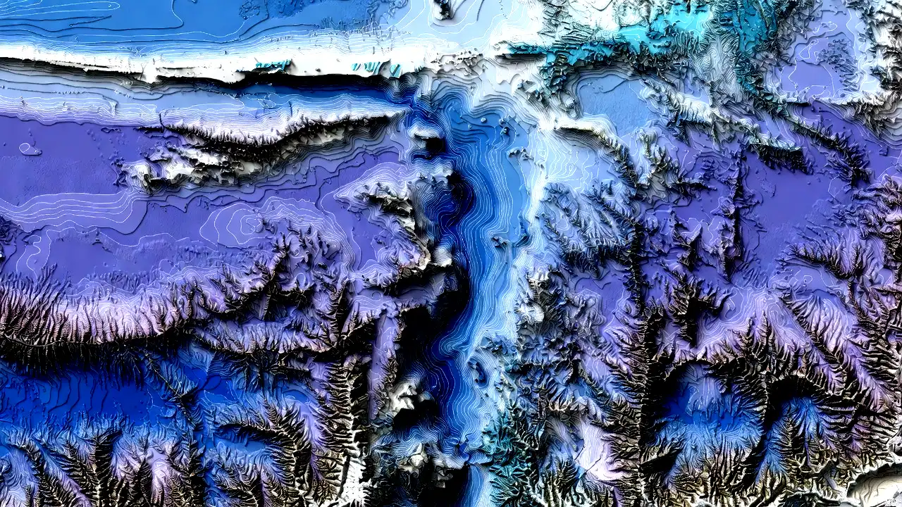
Beneath the vast and seemingly endless expanse of Earth’s oceans lies a world of captivating complexity and diversity. Oceanic topography, the study of the underwater landscape, provides crucial insights into the structure of the seafloor, its geological features, and the mysteries that have long eluded human exploration. In this article, we embark on a journey to explore the significance of oceanic topography, the methods used for mapping the seafloor, and the remarkable discoveries that have reshaped our understanding of the world’s oceans.
Oceanic Topography: The Submerged Landscape
Oceanic topography, often called bathymetry, is the scientific study of the underwater landscape. It entails measuring and mapping the seafloor’s topography, including its varying depths, features, and geological characteristics. While the Earth’s terrestrial landscapes are well-documented and widely explored, the seabed remains relatively enigmatic, presenting a frontier of exploration with immense scientific value.
The significance of bathymetry cannot be overstated. It is the oceanographer’s equivalent to terrestrial topography, providing critical insights into the underwater world. Bathymetric data enables scientists to accurately map the seafloor’s topography, revealing underwater mountains, trenches, and ridges. This knowledge is fundamental for understanding Earth’s geological history, tectonic processes, ocean currents, and the distribution of marine life.
Mapping the Ocean Floor
Mapping the ocean floor is an ambitious and technically challenging endeavor. The immense depths, crushing pressures, and vastness of the world’s oceans require innovative technology and specialized methods to explore and map the hidden landscapes.
Echo Sounders and Sonar
One of the primary tools in bathymetry is the echo sounder, a device that uses sound waves to measure the depth of the ocean floor. Echo sounders emit waves that travel to the seafloor and bounce back to the surface when encountering an obstacle. Scientists can accurately calculate the seafloor’s depth by measuring the time it takes for the sound waves to return. This method is known as sonar (Sound Navigation and Ranging) and has been instrumental in mapping most of the world’s oceans.
Satellite Altimetry
Satellite altimetry is a technology that employs radar or laser instruments aboard satellites to measure the height of the sea surface. The seafloor’s topography influences variations in sea surface height and can be used to create global maps of oceanic topography. This method provides a broader view of the seafloor’s large-scale features and is particularly useful for studying large ocean areas.
Autonomous Underwater Vehicles (AUVs)
Autonomous Underwater Vehicles (AUVs) represent a revolutionary leap in seafloor mapping technology. These robotic submersibles have sensors, cameras, and sonar systems, and can navigate autonomously in the deep-sea environment. AUVs have transformed our ability to explore and map the ocean floor with incredible precision, allowing scientists to study previously inaccessible regions and features.
Remarkable Discoveries and Features
The exploration and mapping of oceanic topography have yielded numerous remarkable discoveries, unraveling the mysteries hidden beneath the waves.
Mid-Ocean Ridges
Mid-ocean ridges are underwater mountain ranges that span the globe, characterized by deep trenches and volcanic activity. These ridges are where tectonic plates diverge, creating new seafloor. They serve as hotbeds of geological activity, hosting unique ecosystems and offering insights into Earth’s crustal dynamics. Notable mid-ocean ridges include the Mid-Atlantic Ridge and the East Pacific Rise.
Abyssal Plains
In stark contrast to mid-ocean ridges, abyssal plains are vast, flat expanses of the ocean floor. These featureless regions are covered in fine sediments and serve as burial grounds for marine organisms. Abyssal plains have been instrumental in understanding the processes of sedimentation, carbon cycling, and seafloor geology.
Trenches and Subduction Zones
Trenches are the deepest parts of the ocean and are often formed at convergent plate boundaries, where one tectonic plate subducts beneath another. The Mariana Trench, home to the Challenger Deep, is the world’s deepest trench. These features offer insights into plate tectonics, seismic activity, and the extreme conditions of the deep sea. They also provide unique ecosystems and are essential for understanding subduction zone dynamics.
Significance for Scientific Research
Oceanic topography is paramount for scientific research, contributing to our understanding of Earth’s history, climate, and marine ecosystems.
Climate and Ocean Currents
Bathymetry is pivotal in understanding how the seafloor’s shape influences ocean circulation patterns and currents. This knowledge is fundamental for studying climate dynamics, including the movement of heat around the planet. Understanding the ocean’s topography helps scientists predict weather patterns, sea-level changes, and the distribution of marine life.
Marine Conservation
Mapping the seafloor aids marine conservation by identifying vulnerable habitats like coral reefs, seamounts, and deep-sea ecosystems. Protecting these areas is essential for preserving biodiversity and mitigating the impact of human activities. Oceanic topography guides marine protected area (MPA) planning and helps define regions that require special conservation attention.
Conclusion
Oceanic topography is a gateway to the hidden world beneath the waves, offering profound insights into Earth’s geological history, oceanic processes, and the mysteries of the deep sea. Through innovative technologies, collaborative international efforts, and the unyielding curiosity of scientists and explorers, we continue to unveil the secrets of the seafloor’s contours and features.
As we explore and map oceanic topography, we gain a deeper appreciation for the complexity and interconnectedness of Earth’s systems. The discoveries in the ocean’s depths expand our scientific knowledge and underscore the importance of conserving these fragile and vital ecosystems for future generations. Oceanic topography is a testament to human curiosity and the quest to unravel the mysteries of our planet’s hidden landscapes, reminding us of the vast wonders beneath the waves.


