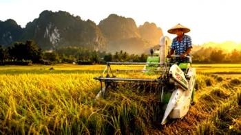
Farming in Southwest China has always required intense physical labor. In the sprawling municipality of Chongqing, agricultural workers have spent generations struggling against a hostile landscape. More than 70% of the region’s land consists of steep hills and rugged mountains. Because of this difficult geography, rural communities must plant crops on small, scattered plots tucked between rocky slopes, deep gullies, and winding, narrow dirt roads. Local farmers often joke that their fields are as tiny as “palms” or “chicken nests,” making traditional large-scale tractors and harvesting machinery completely useless.
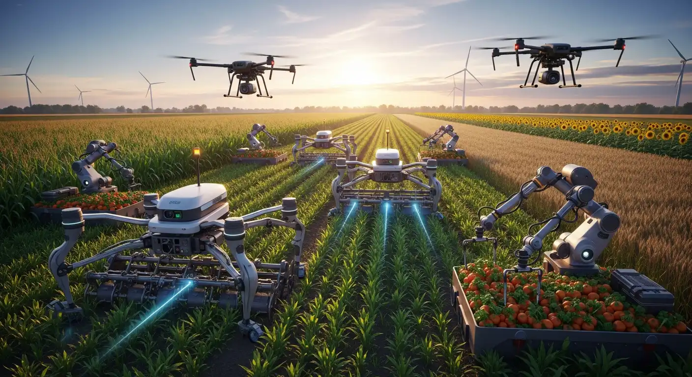
Today, agricultural drone technology is quietly solving these geographic challenges. During the spring planting season, unpiloted flying machines soar over mountain terraces, carrying out the heavy work that once broke the backs of local laborers. These drones are taking over the most repetitive, exhausting farm tasks, reducing physical strain on aging workers and ushering in a new era of digital precision in hard-to-reach mountain fields.
Understanding the Challenge of Mountain Farming
To appreciate how much drone technology has changed mountain farming, we must first look at the unique physical hurdles of the Chongqing region. Unlike the massive, flat plains of the American Midwest or northern China, where industrial tractors can navigate thousands of acres in a single day, mountain agriculture is highly fragmented. Steep slopes make it dangerous to operate traditional wheeled vehicles, as tractors can easily roll over on uneven terrain.
Consequently, farmers must carry out almost all tasks by hand. During planting and fertilization seasons, laborers must carry 20-kilogram tanks of fertilizer or pesticides up and down steep, muddy slopes. This process is not only incredibly slow, but it also causes long-term physical injuries and exposes workers to chemical inhalation. As young people migrate to major cities for high-paying office jobs, rural villages face a severe shortage of physical laborers, threatening the country’s long-term food security.
Key Components of Precision Mountain Agriculture
Modern agricultural drones rely on a highly integrated suite of software and hardware to operate safely in rugged mountain terrains:
- Autopilot Flight Path Navigation: Real-time kinematic (RTK) global positioning networks allow drones to follow precise, pre-calculated flight paths to within millimeters without requiring active human pilots.
- Variable-Rate Spraying Systems: Intelligent pumps adjust the flow of liquid pesticides or granular fertilizers based on flight speed, ensuring even distribution across uneven slopes.
- Multispectral Aerial Imaging: Specialized onboard cameras capture light reflection across multiple bands, helping agricultural experts map crop health and analyze soil conditions from the sky.
- Obstacle Avoidance Radar: Active phased-array radars scan the surrounding environment in 360 degrees, allowing drones to detect and avoid power lines, fruit trees, and rocky cliffs in real time.
- Autonomous Payload Dispensers: Quick-release mechanism designs allow ground crews to swap out liquid-spraying tanks for granular seed spreaders in less than 30 seconds, maximizing flight time.
The Efficiency Breakthrough: Labor and Cost Savings
The actual performance data of these unpiloted aircraft shows a massive efficiency leap for mountain farming. According to Jiang Lixiang, the technical director of the Chongqing Tianzhongyang Agricultural Technology Cooperative, a single agricultural drone can fertilize about 300 mu (20 hectares) in one day.
When you compare this performance to traditional manual methods, the math is staggering. It would take ten healthy human farmers working by hand for an entire week to fertilize that same 300 mu of rugged land. A single drone can match that entire output in roughly eight hours.
This efficiency gain dramatically lowers production costs. Hiring ten manual laborers for a week requires a substantial financial investment in wages, meals, and safety gear. In contrast, operating a drone requires only a single technician, a spotter, and a set of rechargeable lithium-ion batteries. By reducing labor costs, farming cooperatives can lower the wholesale price of mountain-grown crops, raising profit margins for local rural families and keeping mountain agriculture economically viable.
Precision Farm Management: Beyond Spraying and Seeding
While spreading fertilizer and spraying pesticides are the most common uses for agricultural drones, these machines have evolved into versatile data-gathering platforms. Armed with high-definition cameras, thermal sensors, and multispectral scanners, unpiloted aircraft are introducing precision management to remote fields.
Multispectral Crop Growth Monitoring
Drones can scan a mountain field in minutes, collecting spectral data that indicates how well the plants are absorbing nutrients. By using the Normalized Difference Vegetation Index (NDVI), the drone’s software can generate detailed health maps of a hillside terrace. This data tells farmers exactly which plots need more water, which need a nitrogen boost, and which are thriving, eliminating guesswork.
Targeted Weeding and Pest Control
Instead of spraying an entire hillside with chemical herbicides to kill weeds, drones use targeted weeding programs. The drone’s onboard cameras locate weed patches, and the flight software directs the nozzles to spray only those specific coordinates. This targeted approach can reduce chemical usage by 30% to 40% and cut water consumption by over 80%, protecting local mountain water sources from toxic runoff.
Infrastructure and Post-Disaster Inspections
Southwest China regularly experiences heavy monsoon rains and extreme weather events that can trigger landslides, wash out rural roads, and collapse retaining walls. Sending human workers to inspect these mountain hazards is incredibly dangerous. Instead, farming cooperatives deploy drones to inspect irrigation channels, mountain roads, and terraces immediately after a storm, allowing teams to spot infrastructure damage safely from a distance.
The Global Market for Agricultural Drones in 2026
The success of mountain drones in Chongqing is part of a massive global trend. Economic market reports project that the global agricultural drone market will reach $6.5 billion by the end of 2026, representing a compound annual growth rate of 22.4% over the last five years.
Major hardware developers like DJI and XAG are leading this global growth. These companies have designed high-payload aircraft, such as the DJI Agras T50 or the XAG P100 Pro, which can carry up to 50 kilograms of liquid or granular payloads.
To make these advanced tools accessible to smallholder farmers who cannot afford the $10,000 to $15,000 retail price of an industrial drone kit, rural areas are utilizing cooperative business models. Farming cooperatives purchase the drone kits and lease them out to local communities along with certified operators. This shared-economy model allows individual families to access advanced tech for a small daily fee, completely changing the economics of small-scale farming.
Overcoming Obstacles in Autonomous Mountain Farming
Despite the massive benefits, deploying agricultural drones in mountain environments still presents significant technical and social challenges that developers are actively trying to solve.
Battery Life and Payload Constraints
Climbing steep mountain slopes with a 50-kilogram payload rapidly drains lithium-ion batteries. In flat plains, a drone can easily fly for 15 to 20 minutes on a single charge. In rugged terrains, that flight time can drop by 30% due to the constant altitude adjustments required to follow the hillside. To bypass this limitation, operators must bring portable gasoline generators or fast-charging battery docks to the field, allowing them to recharge batteries in under ten minutes.
Signal Loss and Mountain Topography
Cliffs and deep gorges can easily block GPS and RTK satellite signals. If a drone loses its positioning signal, it can drift off course and crash into a hillside or a power line. To solve this issue, drone companies are using localized portable ground stations that broadcast dedicated radio signals directly to the aircraft, maintaining steady flight paths even in deep, shadowed valleys.
Training and Digital Literacy for Aging Farmers
The average age of farmers in rural Southwest China is rising quickly as young people move away. Operating an advanced drone requires a high level of digital literacy, which can be difficult for older generations to master. To bridge this gap, agricultural cooperatives are training young, tech-savvy “drone pilots for hire” who travel from village to village to perform spraying and seeding services on demand, ensuring that elderly farmers can still enjoy the benefits of modern technology.
Future Trends in Autonomous Agriculture
As we look toward the future of smart farming, agricultural drones are set to become even more autonomous, relying on artificial intelligence and collaborative flight technologies to manage crops.
AI-Driven Predictive Yield Models
In the coming years, machine learning algorithms will automatically combine multi-year drone flight data with local weather patterns to predict crop yields down to the exact kilogram. This data will enable cooperatives to negotiate crop prices with wholesale buyers months before harvest, providing smallholder families with financial stability.
Swarm Drone Technology for Mountain Management
Instead of operating a single aircraft, future farmers will deploy small swarms of coordinated drones to manage a hillside. While one drone scans the field for pests, another will follow immediately behind to spot-spray the affected areas. In contrast, a third drone carries fresh payloads from a nearby recharging dock, creating a continuous, automated maintenance loop.
Conclusion
The successful deployment of agricultural drones in Chongqing shows that geography is no longer an absolute barrier to modern farming. By replacing exhausting manual labor with unpiloted flight, technology is helping mountain communities save labor, cut costs, and manage crops with incredible precision. While battery-life limits and signal blockages still pose challenges, the rapid growth of the global drone market and the rise of local farming cooperatives ensure that these aerial tools are here to stay. Ultimately, agricultural drones are proving that even the most difficult, fragmented plots of land can benefit from the digital age, securing the future of mountain farming for generations to come.